Forrestfield / High Wycombe Industrial Area Stage 1
Share Forrestfield / High Wycombe Industrial Area Stage 1 on FacebookShare Forrestfield / High Wycombe Industrial Area Stage 1 on TwitterShare Forrestfield / High Wycombe Industrial Area Stage 1 on LinkedinEmail Forrestfield / High Wycombe Industrial Area Stage 1 link
Consultation has concluded
The planning for Stage 1 is now complete. The area is now being developed under the Industrial Development zone, in accordance with the adopted Structure Plan and taking into consideration the Design Guidelines for the area.
Following the announcement of the rail station, the WA Planning Commission has requested that the City consider the implications of the Forrestfield Rail Link on the surrounding areas in Forrestfield and High Wycombe.
The City has been instructed by the State Government to prepare a new District Structure Plan over the areas commonly known as Stages 2 and 3, in order to identify whether new land use opportunities ought to be considered to take advantage of the Forrestfield train station. These changes would still require the rezoning process underway to continue, so the City will continue to pursue it as a priority.
For information regarding land use planning for areas formerly known as Stage 2 and 3 please refer the Forrestfield North project.
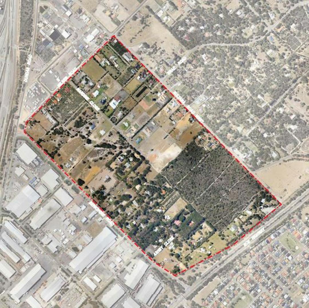
Background The Forrestfield/High Wycombe Industrial Area – Stage 1 Local Structure Plan (the Structure Plan) relates to 69 land parcels held in various public and private ownership and generally bounded by Roe Highway, Berkshire Road, Milner Road and Sultana Road West (the subject land). View more information and associated project information
The planning for Stage 1 is now complete. The area is now being developed under the Industrial Development zone, in accordance with the adopted Structure Plan and taking into consideration the Design Guidelines for the area.
Following the announcement of the rail station, the WA Planning Commission has requested that the City consider the implications of the Forrestfield Rail Link on the surrounding areas in Forrestfield and High Wycombe.
The City has been instructed by the State Government to prepare a new District Structure Plan over the areas commonly known as Stages 2 and 3, in order to identify whether new land use opportunities ought to be considered to take advantage of the Forrestfield train station. These changes would still require the rezoning process underway to continue, so the City will continue to pursue it as a priority.
For information regarding land use planning for areas formerly known as Stage 2 and 3 please refer the Forrestfield North project.
Background The Forrestfield/High Wycombe Industrial Area – Stage 1 Local Structure Plan (the Structure Plan) relates to 69 land parcels held in various public and private ownership and generally bounded by Roe Highway, Berkshire Road, Milner Road and Sultana Road West (the subject land). View more information and associated project information